Lake Manasarovar Pilgrimage
It usually needs 4 days to finish a Pilgrimage around Lake Manasarovar and the walking distance is about 115 km (71 mi). According to Buddhist tradition, you should head in a clockwise direction from Chiu Monastery, traveling northeastward to the north shore of the Lake. This circular route is regarded as a consecrate pilgrimage. The trail is lined by many Mani stones nearly 2 meters (6.5 feet) high.
From Gonggar Airport, you can take airport shuttle bus to Lhasa Train Station. Then, you can arrive at Shigatse by train in 2.5 hours and the ticket price is only CNY 64 for a second class seat. Upon arrival in Shigatse, you can rent a jeep to Ngari Prefecture. There is also a highway bus running between Shigatse and Mount Kailash, which is priced at CNY497. The bus drivers would provide transportation information from Mount Kailash to the Lake. Backpackers usually choose Chiu Monastery as their base, 35 km (22mi) southeast of Darchen. The nearest hotel from the temple would charge about CNY450 per night.
Walking distance: 35 km(22 mi)
Time needed: about 8 hours
On the first day, please start your pilgrimage from Chiu Monastery. Note that CNY150 is needed as the admission fee for Holy Lake Mansarovar. Walking northeastward, you can find that the trail would gradually leave far from waterline and ascends over the top of a red escarpment for a 2-hour walk.
Watch out for the cliffs below and they are sprinkled with caves that have been used by religious practitioners for centuries. Some of these caves have been converted into permanent homes. From the grass-capped top of the escarpment, the route descends into a small road. Here, the ruins of Cherkip Monastery can be seen. Until now, you will have walked for over two hours from Chiu Monastery.
From Cherkip Monastery, it is faster to follow the trail eastward to Langbona Monastery, which can be reached in 90 minutes. Along the trail, there is also a lakeshore route passing by more caves and cliffs. When the escarpment ends, look for the trail going north along the Gyuma valley to Langbona on the west bank of the Gyuma-chu.
In the east of Langbona, the trail traverses a marshy plain. You can walk to the settlement of Hor in the next 4 hours. Please remember to look for a series of tracks heading towards the distant margin of the plain.
With regard to accommodation, there are hotels of different prices in Hor. Many hotels have rooms priced within CNY100 per night for a stand room. Or you can also purchase a tent in the shop of Hor. Hor is the best place from which to take photos of Mt. Naimonanyi.
Important tip: You are forbidden to walk close to the edge of the lake from Langbona, as the swamps along this part of the lakeshore give way to several lakes that flow into Manasarovar, effectively blocking the route to all but birds and fish.
Walking distance: 13 km (8 mi)
Time needed: 3- 5 hours
The next morning, please leave Hor by walking along the trail in the southwest, as this trail would help you avoid the extensive swamps abutting the lake. Walking for a while, you need to cross a bridge over the Samui-chu Valley, and the main road in the east initially follows this valley. South of the swampy tracts, the trail rejoins the lakeshore along a stone beach. Now, kook out for white-and-black polished stones as they are sacred to both Buddhists and Hindus. The route squeezes between the water and a cliff, before a side valley where Seralung Monastery appears. The admission fee of the temple is CNY15.
It is suggested that you camp in your own tent for a night. Although you can find some local people's houses scattered there, language difference may be a barrier.
Important Tip:
Don't walk directly to the bank of the lake, as the lake you see is accumulated water swag instead of the water in Holy Lake Manasarovar. But you will have a chance to see the unique black-neck cranes, which only exist in Tibet, jumping on this damp spot.
Walking distance: 27 km (17 mi)
Time needed: 6 - 8 hours
Retreating from the Seralung Monastery, you can see a section of rough road on the slope of the mountain. It’s more comfortable to walk on this road than on the former soft sand route. However, you will turn back to the trail along the lake again soon. This trail moves inland about 1 kilometer (0.6 mi), and later you need to cross the bridge over the Tag Tsangpo River to avoid the torture of paddling in the water. Up the valley, there are extensive hot springs and geysers as well as Bon and Buddhist sites. About 3 hours later from the Trag Tsangpo Bridge, you will stand in the south side of Manasarovar. Here, you can see Yerngo Monastery ruins situated in a broad plain. In the south area of the plain, the massive flanks of the Gurla Mandata (7,728m or 25,354 feet) massif rise up to a heavily glaciated summit.
For the last 1 hour’s walking (4 km or 2.5 mi), you will reach Trugo Monastery. The temple is a perfect place to see the Holy Lake and Holy Mountain – Kailash. You can stay for an overnight near the temple and the price is CNY10 per bed.
Walking distance: 40 km (25 mi)
Time needed: about 10 hours
The fourth day will be a day to test your boots for waterproof capability, as numerous water pits are scattered like a net on the band of the lake. That day also means walking on a soft sand path, thus uneasy. Luckily, limpid water is in sight along the whole path, which might comfort you a bit.
Starting from Trugo Monastery, you can see a motorable track shoots over the hills in the southwest of the lake. The track would finally join the Purang-Darchen road. Along the way, you need to walk on swampy ground for hours first. Gradually, the swampy ground gives way to sandy expanses near the southwest corner of Manasarovar. Walking for about 2 hours, you will come to a path which is surrounded by Manasarovar on its right side & Shushup-tso Lake on the left side. Till now, there is still 2 hours’ walking from Gotsmk Monastery, while Chiu monastery is about 20 km (12 mi) far away.
 |
| Lake Manasarovar |
Pre-trekking Suggestion:
Four-day Itinerary of Lake Manasarovar Pilgrimage
1st Day: Chiu Monastery – Cherkip Monastery - Langbona Monastery - Hor
Time needed: about 8 hours
On the first day, please start your pilgrimage from Chiu Monastery. Note that CNY150 is needed as the admission fee for Holy Lake Mansarovar. Walking northeastward, you can find that the trail would gradually leave far from waterline and ascends over the top of a red escarpment for a 2-hour walk.
Watch out for the cliffs below and they are sprinkled with caves that have been used by religious practitioners for centuries. Some of these caves have been converted into permanent homes. From the grass-capped top of the escarpment, the route descends into a small road. Here, the ruins of Cherkip Monastery can be seen. Until now, you will have walked for over two hours from Chiu Monastery.
|
|
In the east of Langbona, the trail traverses a marshy plain. You can walk to the settlement of Hor in the next 4 hours. Please remember to look for a series of tracks heading towards the distant margin of the plain.
With regard to accommodation, there are hotels of different prices in Hor. Many hotels have rooms priced within CNY100 per night for a stand room. Or you can also purchase a tent in the shop of Hor. Hor is the best place from which to take photos of Mt. Naimonanyi.
Important tip: You are forbidden to walk close to the edge of the lake from Langbona, as the swamps along this part of the lakeshore give way to several lakes that flow into Manasarovar, effectively blocking the route to all but birds and fish.
2nd Day: Hor - Seralung Monastery
Time needed: 3- 5 hours
 |
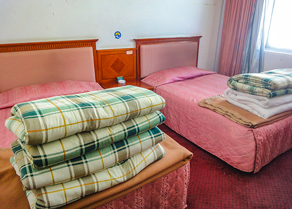
| Lodge |
It is suggested that you camp in your own tent for a night. Although you can find some local people's houses scattered there, language difference may be a barrier.
Important Tip:
Don't walk directly to the bank of the lake, as the lake you see is accumulated water swag instead of the water in Holy Lake Manasarovar. But you will have a chance to see the unique black-neck cranes, which only exist in Tibet, jumping on this damp spot.
3rd Day: Seralung Monastery – Tag Tsangpo River - Yerngo Monastery ruins - Trugo Monastery
Time needed: 6 - 8 hours
Retreating from the Seralung Monastery, you can see a section of rough road on the slope of the mountain. It’s more comfortable to walk on this road than on the former soft sand route. However, you will turn back to the trail along the lake again soon. This trail moves inland about 1 kilometer (0.6 mi), and later you need to cross the bridge over the Tag Tsangpo River to avoid the torture of paddling in the water. Up the valley, there are extensive hot springs and geysers as well as Bon and Buddhist sites. About 3 hours later from the Trag Tsangpo Bridge, you will stand in the south side of Manasarovar. Here, you can see Yerngo Monastery ruins situated in a broad plain. In the south area of the plain, the massive flanks of the Gurla Mandata (7,728m or 25,354 feet) massif rise up to a heavily glaciated summit.
For the last 1 hour’s walking (4 km or 2.5 mi), you will reach Trugo Monastery. The temple is a perfect place to see the Holy Lake and Holy Mountain – Kailash. You can stay for an overnight near the temple and the price is CNY10 per bed.
 |
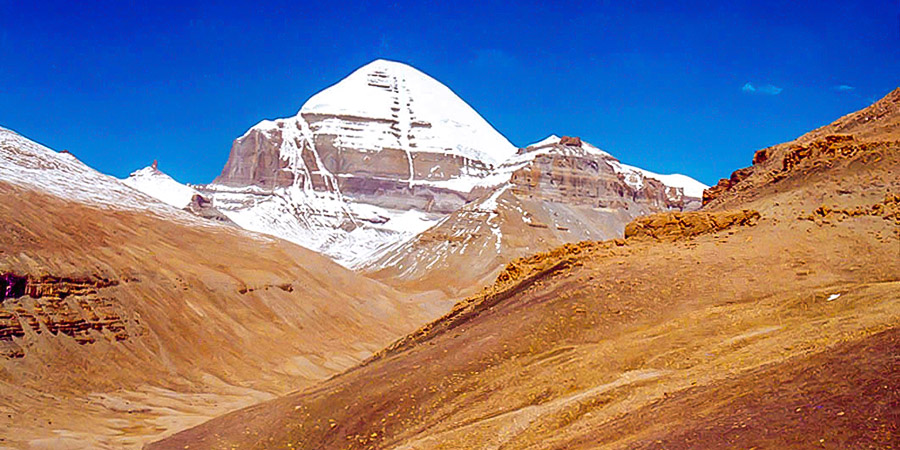
| Golden Mount Kailash |
4th Day: Trugo Monastery - Chiu Monastery
Time needed: about 10 hours
 |
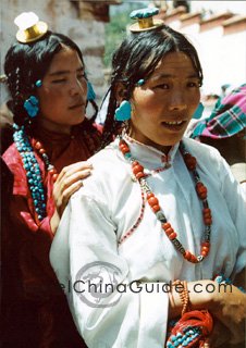
| Tibetans |
Starting from Trugo Monastery, you can see a motorable track shoots over the hills in the southwest of the lake. The track would finally join the Purang-Darchen road. Along the way, you need to walk on swampy ground for hours first. Gradually, the swampy ground gives way to sandy expanses near the southwest corner of Manasarovar. Walking for about 2 hours, you will come to a path which is surrounded by Manasarovar on its right side & Shushup-tso Lake on the left side. Till now, there is still 2 hours’ walking from Gotsmk Monastery, while Chiu monastery is about 20 km (12 mi) far away.
Recommended Tours
- Last updated on Oct. 23, 2024 by Zoey Gong -

