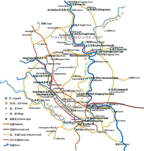
Yangshuo Map
Yangshuo is a small county located about 65 kilometers (40 miles) southeast of Guilin in Guangxi Zhuang Autonomous Region. It is connected with downtown Guilin by the Li River. Lying along the west bank of the picturesque Li River, this small county is famous for tourism. A Chinese saying goes that 'while the most beautiful scenery in China is in Guilin, the most fascinating part of a Guilin tour is in Yangshuo'.
A tourist map of Yangshuo is offered here to clearly show visitors the major scenic spots in the area. Both English and Chinese notes are available. With typical karstic landform, Yangshuo is endowed with charming natural scenery. Attractions along the Li River are highly recommended, including the Crown Cave, One-Side Ferry, Langshi Scenery, Nine-Horse Fresco Hill, Yellow Cloth Shoal, Lotus Cave, Shutong Hill, Jianshan Temple, Big Banyan and Moon Hill. Visitors can appreciate them when having a Li River cruise. Moreover, Sanjie Liu Above-Water Park along the lower reaches of Li River, the West Street in downtown Yangshuo, Yulong River scenic area in southwest of the county are also worth visiting.
